Talus
Advertisement
RapidDXF
RapidDXF reads ASCII (text) or XLS (Microsoft Excel) files of coordinates and creates DXF (version 12) files of points and thier attributes. The DXF files so created are usable in many CAD software. RapidDXF can process several files at a time and lets

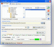
Dxf2Bom
Dxf2Bom is an application that allows to extract value of block attributes from DXF files and to export them to Text of Excel files. Dxf2Bom can be used for several purposes : counting blocks, building Bill of Materials, computing areas... Dxf2Bom can
Advertisement
GeoDataSource World Land Features Database (Basic March v.2007
GeoDataSource Land Features Database Basic Edition contains land feature names in original language and English, feature type classifications, country names in FIPS and ISO, regions and sub-regions.
FlashSnap for AutoCAD v.2.0
FlashSnap is a replacement for the standard AutoCAD Object Snap dialog.
GeoDataSource World Land Features Database (Premiu February v.2
GeoDataSource Land Features Database Premium Edition contains land feature names in original language and English, feature type classifications, country names in FIPS and ISO, regions and sub-regions.
GeoDataSource World Land Features Database (Gold E November v.2
GeoDataSource Land Features Database Gold Edition contains land feature names in original language and English, feature type classifications, country names in FIPS and ISO, regions and sub-regions.